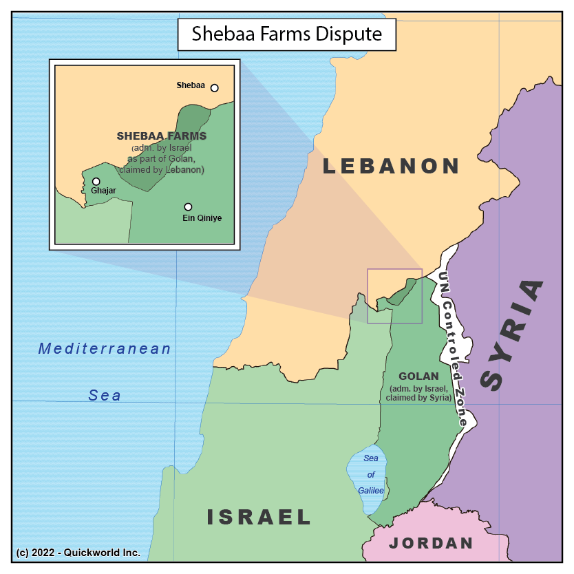
Our Series on Tiny Disputes takes us to the border region between Israel and Lebanon, in the vicinity of Mount Hermon. The exact location of the border has been in dispute for a century, in a region whose only human presence is a couple of farms known as the Shebaa Farms.
The dispute dates from the early time of the French Mandate in the Levant that followed World War One. Surveyors drew the line at the limit between the Litani and Jordan River watersheds, putting the land in Syrian territory, while locals mentioned that they had paid their taxes to the Ottoman governor in Beirut, putting it in Lebanese territory. While actual control remained Syrian for a long time, Lebanon registered a formal dispute over the farms.
Things became more conflictual after Israel occupied and then annexed the Syrian land known as the Golan Heights, which includes the Shebaa Farms. The Israeli occupation of Southern Lebanon between 1985 and 2000 was concluded with a UN-supervised withdrawal from the region. As the United Nations acknowledged complete Israeli withdrawal from Lebanese territory, some Lebanese factions, most importantly the Shia Muslim Hezbollah, considered the Shebaa Farms region to be still under occupation and, as of 2022, justify artillery attacks on the State of Israel by the continued occupation of Lebanese territory.
This is one strong example of the gap between the geographic dimension of a territorial dispute and its political dimension.
The Shebaa Farms Dispute


