This map of the Middle East in 1950 is much different from a similar map five years earlier. By the end of World War II, Palestine and Transjordan were still British protectorates, while Syria was still under French protection. Lebanon had been granted independence from France in 1943, but it was still under Franco-British military control at the end of the War.
The immediate after-war changed the status of these territories in close order. Syria and Transjordan became independent in 1946 and the status of British Palestine remained in debate due to the diverging views of the Arab majority, who favoured a unitary state under their control, and the Jewish minority, who hoped for a partition and the creation of a Jewish state on parts of the British Mandate territory.
The United Nations, a new organization that took over the supervision of the League of Nations' International Mandates, proposed a partition plan in 1947 after coming to the conclusion that a joint administration for Jewish and Arab entities would lead to armed conflict. The British withdrew their troops in 1948 and the Jewish entity declared its independence as the State of Israel. The Arab Palestinians refused the partition and, with the help of the neighbouring Arab states, started a war to reclaim all land. The subsequent Israeli victory enabled the young Jewish state to increase their territory, and left only two relatively small territories under Arab control: in the Southwest, a narrow strip around the city of Gaza came under Egyptian protection, while in the East, a territory on the West bank of the Jordan River was annexed by Transjordan, which consequently renamed itself Jordan.
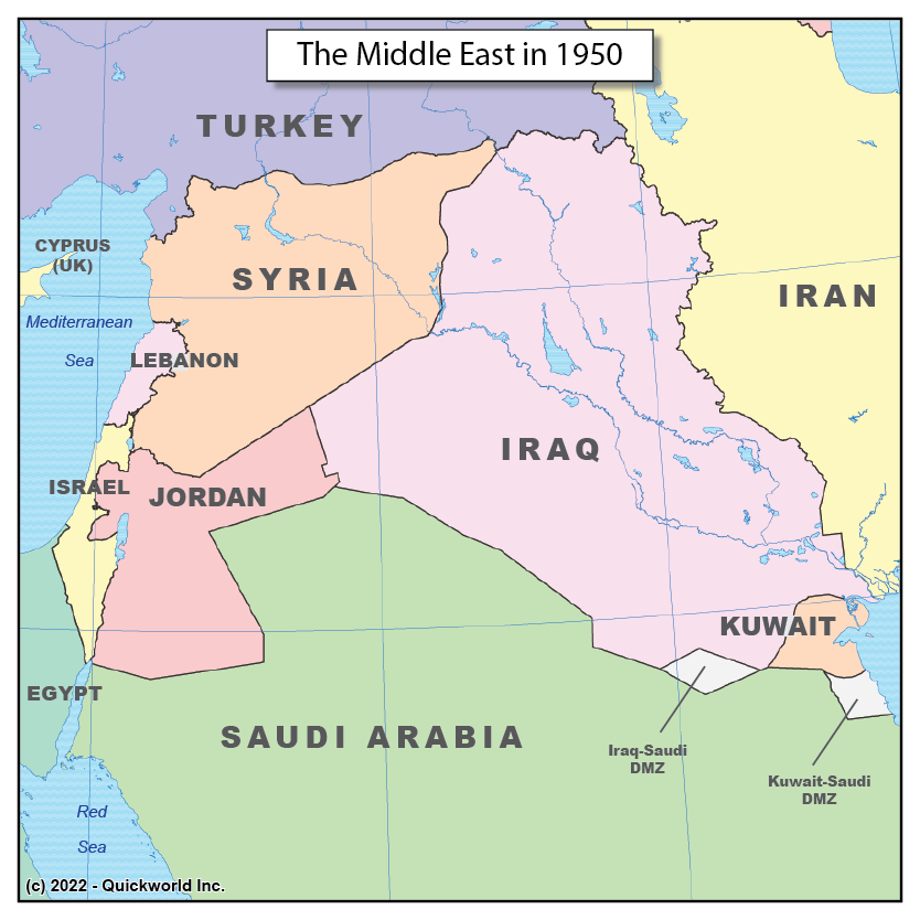
The Middle-East in 1950