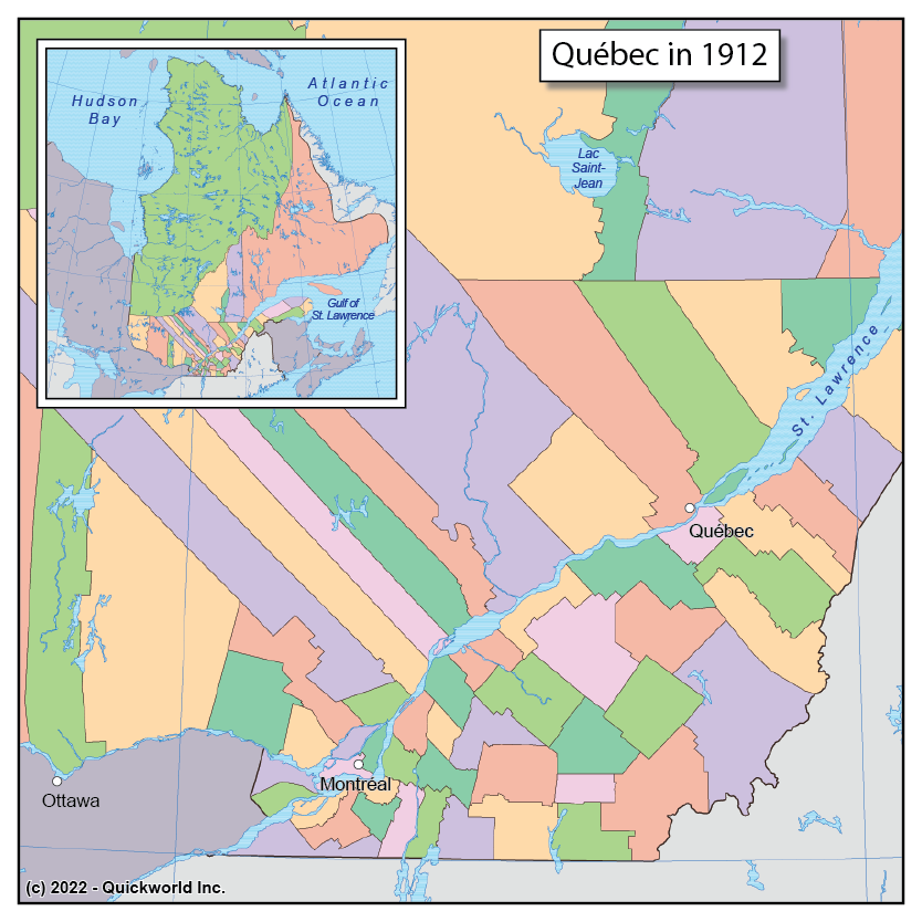
Our series on Territorial Formation takes us to Quebec, one of the provinces of Canada.
Dating back centuries, the watersheds of all rivers that flowed toward the Bay of Hudson were separate from the Canadian colonies and provinces, which thus left most of Labrador as a district of the Northwest territories, administered by the Federal government. In 1912, at a time when the exploitation of resources was becoming vital to the Canadian economy, the Federal government granted lands to Quebec and Ontario all the way to the Hudson Bay and Ungava Bay. The new district of Quebec was named Territoire-du-Nord and added to the existing 70 counties that formed the province.
This map shows all counties and district as they existed after the 1912 extension. The British-era county structure was replaced in the 1980s by a dual level of regions and regional municipalities.
Quebec in 1912


