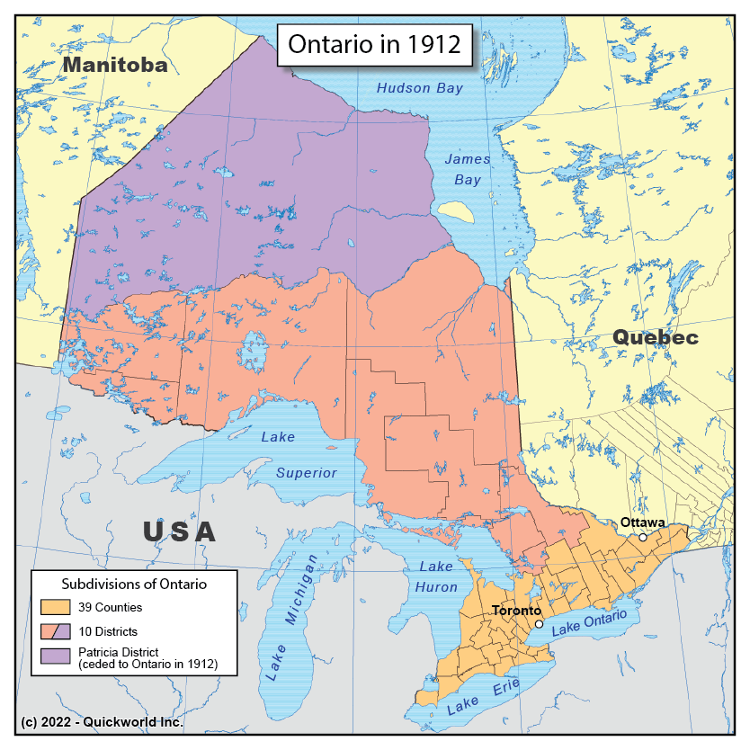
Our Series on Territorial Formation takes us to Ontario in the Year 1912, when the Canadian Province reached its current borders.
The original limits of Upper Canada, which would become Ontario, were the Ottawa River to the West with Lower Canada, the St Lawrence River and the great Lakes to the South with the United States, and the limits of St Lawrence and Hudson's Bay watersheds to the North with Rupert's Land.
Ontario and Quebec were given gradually more lands to the North as people settled more lands, and in 1912, the final borders of both Provinces were drawn, reaching the Hudson Bay on its Western and Eastern side.
Ontario in 1912


