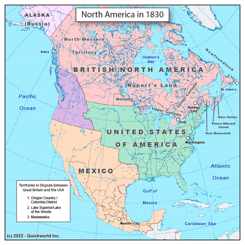
This map shows North America as it was in 1830, that is, after the war of 1812 which confirmed the presence of Great Britain in North America, and before the 1848 war with Mexico that gave the USA its current Southern border.
As of 1830, there are only four powers at play on the North American continent. The departure of colonial powers such as the Netherlands, France and Spain only leave Russia and Great Britain as colonial powers along with Mexico and the USA, which were still young nations.
Some noticeable features on this map are:
- the Oregon Territory/Columbia District, a joint British-American territory that was cut at the 49th Parallel in 1846
- the vast expanses of Northern Mexico, which includes the modern US states of California, Nevada, Arizona, New Mexico, Utah, Texas and parts of Colorado.
- Russian America, which was sold to the USA in 1867 and later became the State of Alaska.
- Some minor border disputes between the United States and British North America, which were ultimately resolved in 1842.
North America in 1830