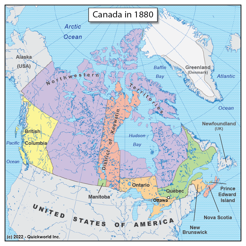
With the exception of Newfoundland and Labrador, which had opted out of Confederation in 1867, the Canadian landmass reached its current form after the transfer of Arctic islands from the United Kingdom to the Canadian Dominion in 1880.
What stands out on this map is the sheer size of the Northwestern Territories (NWT), which cover much more than the current Yukon, Nunavut, and Northwest Territories. The early Northwestern Territories included the future provinces of Alberta and Saskatchewan, as well as major parts of Manitoba, Québec and Ontario. Yukon Territory was split from the NWT in 1898 during the Klondike gold rush. Alberta and Saskatchewan were created in 1905. That same year, the Keewatin District merged with the NWT. Manitoba, Ontario and Québec reached their current borders in 1912. The border between Québec and Labrador was demarcated in 1927, but some dispute remains between the two provinces in its Southeastern part. Newfoundland and Labrador joined Canada in 1949, and Nunavut was the last established territory in 1999.
More on Canada
Canada in 1880